Over the past few months, we have been reviewing our printed maps of Berkshire collection (Ref: PM) to get a better understanding of just what we have and what they show. We were quite amazed by what we discovered.
The earliest Berkshire map we have, is a facsimile of a map dating from the 1300s which shows all of England at an unusual angle. Some Berkshire towns represented are Wynsour [Windsor], Redyng [Reading] and Hongreford [Hungerford] (ref. PM110). It was reproduced by the Ordnance Survey in 1870, so is an old map of a very old map. Our oldest original map dates from about 1607. This is a printed map with colourful hand illustrations (ref. PM76).
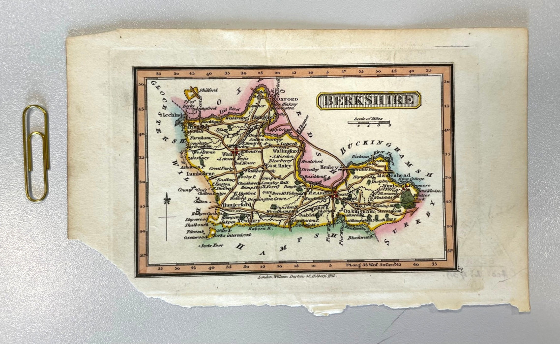
The maps illustrate the whole county of Berkshire, rather than just a small area within it. They vary in size from filling our map table to smaller than a postcard. Many of the smaller maps were originally published in books. Here we see a very small map of the Royal county from 1820 – the paperclip has been added to show just how small it is (ref. PM 29). We think it’s sweet little thing.
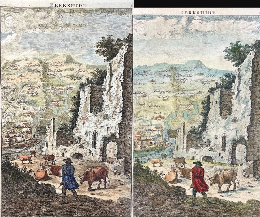
Several maps carry beautifully hand drawn coats of arms, scenes from the county or even portraits They’re almost more like illustrations than the traditional maps you might expect, and these embellishments are listed in the description given in the catalogue. An example can be seen in the image below which depicts Berkshire displayed more on a hillside than a map, with (presumably) a farmer tending to his cows in the foreground beside some ruins (1796, ref. PM 13). A curious ‘map’ really.
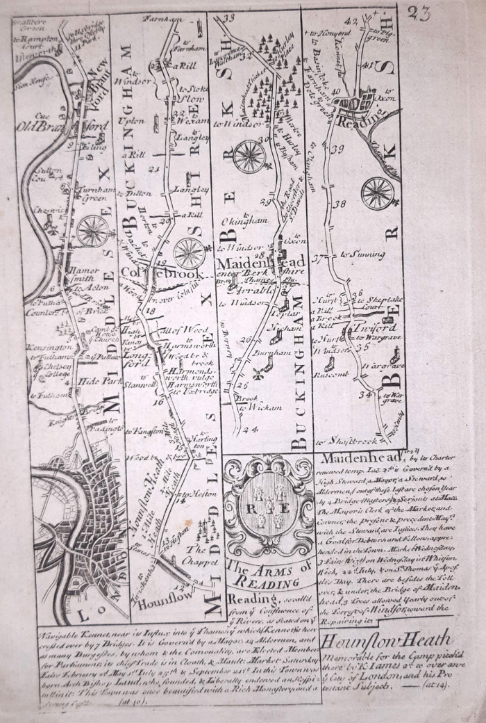
Some of the maps are presented as more as diagrams than maps. This one from 1720 shows sections displayed in strip form (ref. PM 116).
The PM project
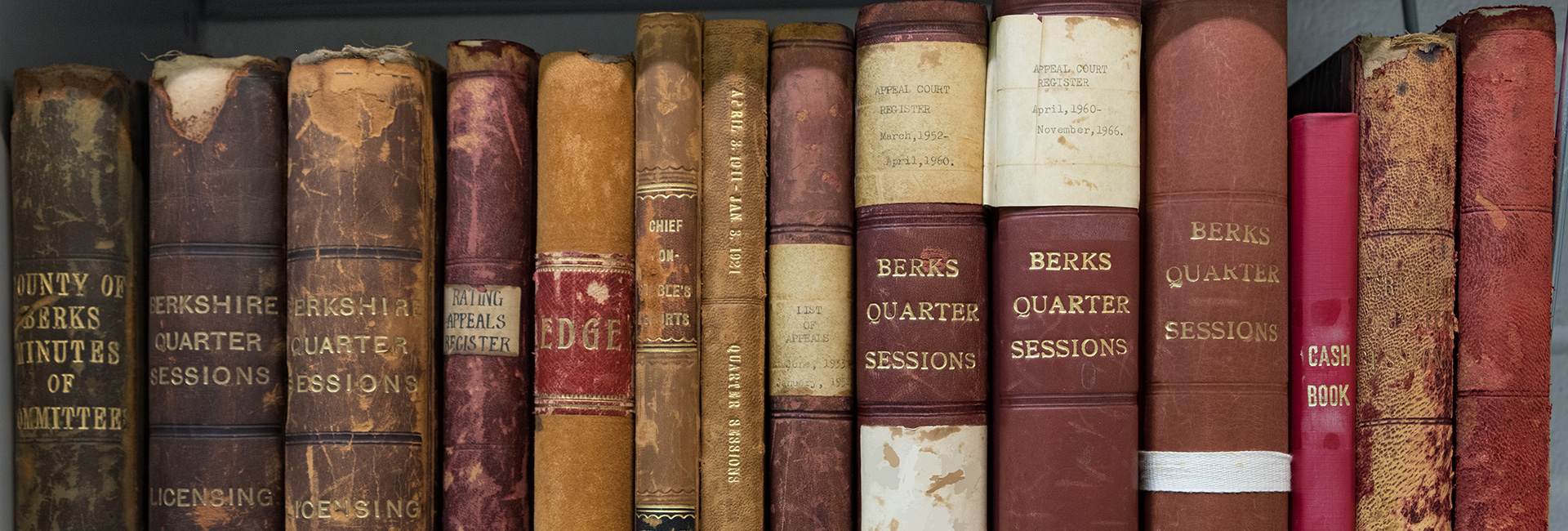
The first task for the project, was to take a look at each map. They were retrieved from the strongrooms and assessed, checking for condition and repackaged when required. For example, some were in frames, which were removed to allow for more space in the strongrooms as well as to remove the potential from damage should the glass become broken. Some maps were of the same print but had been coloured or illustrated by hand making each unique. These have been bought together so that they can be compared and easily retrieved from the strongrooms.
It was then time to review the catalogue. The original was a photocopy of an old card system that went out of use many years ago and over the years had been annotated with handwritten notes. Some of these gave locations from before we moved to our current building. One helpfully said “on windowsill in searchroom”! The catalogue was arranged by the name of the engraver, cartographer or publisher, which was perhaps not the most useful way of looking for a map. It was definitely time for a rewrite.
The catalogue was typed up onto a computer and the entries were then sorted. We now have two versions of the catalogue. One is in order of the catalogue reference, which is useful for the staff, and one is in date order which will be of greater use for visitors. With the joys of modern technology, we can also free text search by name if that is required. The final step will be to put the catalogue online so please do get in touch with us in the meantime if you would like more information about it.
We think that this collection has been under used for far too long, and while the maps may not necessarily be of use to the family historian, they do give an insight into both how the county has developed and how map making has changed.