Members of the Social Media Team get very excited when we get a call from the searchroom that there’s an interesting item being viewed. One day in July 2022, one of our visitors was looking at various maps of Hungerford. One of the maps was from 1831 and it was a plan showing the boundary of Eddington Manor from the rest of Hungerford, prepared in connection with a lawsuit between John Pearse, MP, and the Hungerford Corporation Fishery (reference D/EX2010/6).
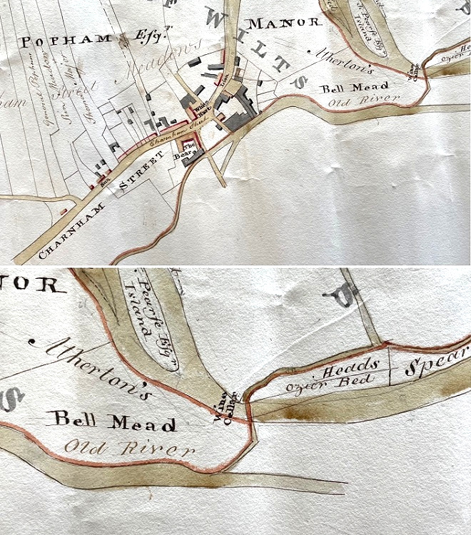
It is a very detailed and coloured plan of the area around Eddington manor, bounded by Leverton Road and Bath Road on the north; Denford Mead on the east, the River Kennet on the south-east; and the Old River on the south. It was these rivers to the south of the map that caused the excitement.
Our visitor was intrigued by a note on the map of ‘Wine Cellar’. This fairly straightforward notation was made surprising by its location, it appeared to be in the middle of a river! They pointed it out to one of the members of staff on duty, who called a member of the social media team to take pictures to share online.
We thought it was just a fun and unique feature that our followers might enjoy seeing. We uploaded the post querying whether it meant that the river had been used as a storage for wine? It went down well with our followers. At the time of writing, the map has received a total of 52 likes across our 3 platforms.
However, this was not the end of the story. After posting the image, we received an email from the West Berkshire archaeology team who were interested in doing some further research into the cellar. They checked some of their maps but could not find it marked anywhere else. They posted it on a forum with other professionals to see if they had come across a similar site.
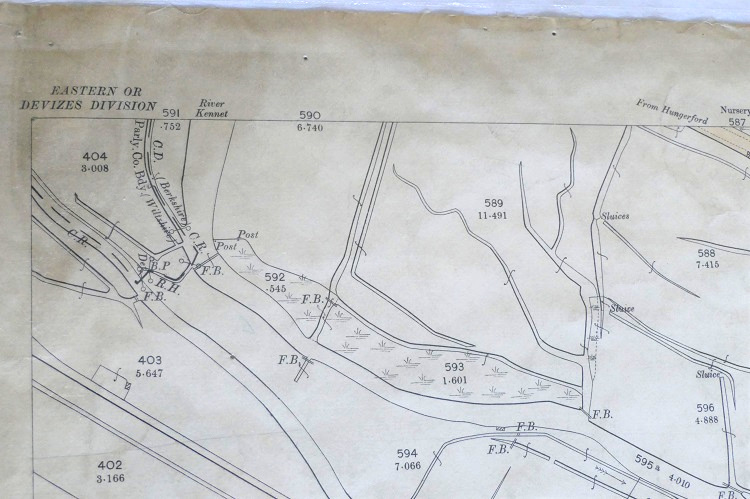
Eventually, with help from the Wiltshire County Council Conservation Office, the site of ‘Wine Cellar Bridge’ was established. The earliest evidence for this footbridge was our 1831 map. However, the West Berkshire archaeology team also found it on the First and Second editions of the OS maps. By the Third Edition map of 1911-24, it had been moved further south-east to its current location.
This all resulted in the bridge getting its own Historical Environmental Record. It can be found through the Heritage Gateway.
We’re still not sure how the connection to the wine cellar came about. Was the river or bridge once used as a storage area for wine or other products? Was the 1831 map showing the presence of a cellar or listing the name of the bridge?
We may never know the answer to these questions, but thanks to the power of social media, we can now visit Wine Cellar Bridge.